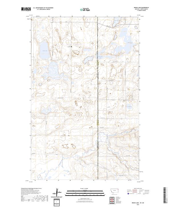
2024 Map of Brush Lake
USGS Topo · Published 2024About this map
Saint Olaf Cem sits in the high prairie landscape of Sheridan County, highlighting the rural heritage of this border region. The map captures the divide between Montana and North Dakota, where the terrain is defined by a dense concentration of glacial potholes and wetlands. Much of this land is dedicated to the Sheridan County Waterfowl Production Area, which encompasses both Brush Lake and several smaller water bodies like Horseshoe Lake and the aptly named Stink Lake. A network of local gravel routes, including Syverud Rd and Wilson Rd, provides access across the townships. Drainage is primarily defined by the seasonal flow of Cottonwood Creek and Willow Creek, which meander through the southern reaches of the quadrangle, reflecting the sparse, water-dependent settlement pattern of the northern plains.
Find a feature on this map
30 named features on this map. Tap any name to fly to it.
Don’t see what you’re looking for? This feature index may not catch every label — zoom into the map to look around manually.
Map Details
Editions of this 2024 Brush Lake Map
This is the sole edition of this map. No revisions or reprints were ever made.
Other maps of this area

1946 · Brush Lake
USGS Topo · 1:24,000

1946 · Dagmar
USGS Topo · 1:24,000

1948 · Grenora
USGS Topo · 1:24,000

1948 · Dagmar
USGS Topo · 1:24,000

1948 · Brush Lake
USGS Topo · 1:24,000

1948 · Sunnyhill School
USGS Topo · 1:24,000

1949 · Sunnyhill School
USGS Topo · 1:24,000

1953 · Williston
USGS Topo · 1:250,000

1954 · Wolf Point
USGS Topo · 1:250,000

1957 · Williston
USGS Topo · 1:250,000