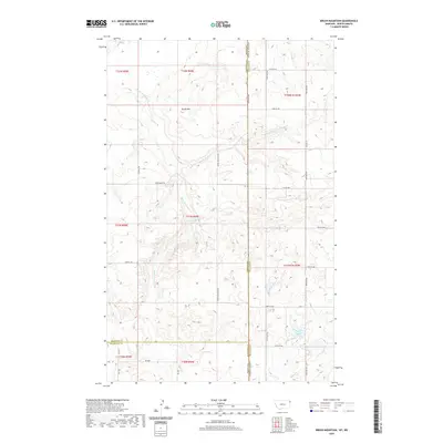
2020 Map of Brush Mountain
USGS Topo · Published 2020About this map
Brush Mtn rises above the high plains of northwest North Dakota and northeast Montana, serving as a primary landmark in a landscape defined by drainage patterns and section lines. The map captures a quiet, rural interior where the state boundary between Montana and North Dakota intersects with Williams, Sheridan, and Roosevelt counties. Water sources, vital to the history of this arid ranching and farming region, are documented through features such as Dead Horse Spring and the drainage of Brush Mountain Cr alongside its E Fork Brush Mountain Cr. A low-lying area named Sweet Slough sits in the eastern portion of the sheet, providing a contrast to the higher ground of the mountain. The grid of service roads, including Chokecherry Rd and Brush Mountain Rd, reveals a modern settlement pattern built upon the original township and range system.
Find a feature on this map
34 named features on this map. Tap any name to fly to it.
Don’t see what you’re looking for? This feature index may not catch every label — zoom into the map to look around manually.
Map Details
Editions of this 2020 Brush Mountain Map
This is the sole edition of this map. No revisions or reprints were ever made.
Other maps of this area

1946 · Brush Lake
USGS Topo · 1:24,000

1946 · Dagmar
USGS Topo · 1:24,000

1948 · Grenora
USGS Topo · 1:24,000

1948 · Dagmar
USGS Topo · 1:24,000

1948 · Brush Lake
USGS Topo · 1:24,000

1948 · Sunnyhill School
USGS Topo · 1:24,000

1949 · Sunnyhill School
USGS Topo · 1:24,000

1953 · Williston
USGS Topo · 1:250,000

1954 · Wolf Point
USGS Topo · 1:250,000

1957 · Williston
USGS Topo · 1:250,000