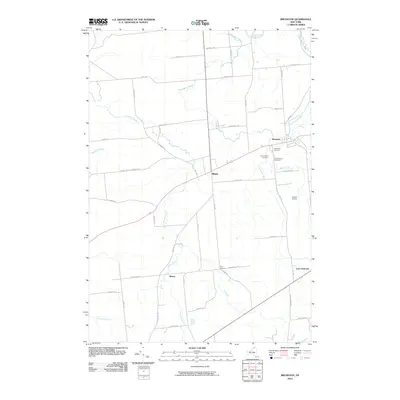
2010 Map of Brushton
USGS Topo · Published 2010About this map
The Little Salmon River and Stony Brook define the hydrologic character of the northern Franklin County countryside, where the small hamlets of Brushton and Moira serve as local centers. This 2010 survey illustrates a landscape of agricultural roads and scattered rural settlements, including Alburg and Irish Corners. A trio of burial grounds north of Moira—Sunnyside Cemetery, Saint Peters Cemetery, and Saint Marys Cemetery—provide essential points of reference for genealogists tracking local families. The transportation network is anchored by a mix of historic routes and more modern connections like Co Rte 5 and the aviation facilities at Ursone Airport. Dozens of named waterways such as Alburg Brook and Farrington Brook drain the gently sloped terrain, illustrating the many small drainage basins that once powered local industry and shaped the placement of farmsteads and village boundaries.
Find a feature on this map
53 named features on this map. Tap any name to fly to it.
Don’t see what you’re looking for? This feature index may not catch every label — zoom into the map to look around manually.
Map Details
Editions of this 2010 Brushton Map
This is the sole edition of this map. No revisions or reprints were ever made.
Other maps of this area

1915 · Malone
USGS Topo · 1:62,500

1915 · Moira
USGS Topo · 1:62,500

1917 · Malone
USGS Topo · 1:62,500

1917 · Moira
USGS Topo · 1:62,500

1919 · Nicholville
USGS Topo · 1:62,500

1921 · Nicholville
USGS Topo · 1:62,500

1921 · Santa Clara
USGS Topo · 1:62,500

1923 · Santa Clara
USGS Topo · 1:62,500

1944 · Moira
USGS Topo · 1:62,500

1948 · Ogdensburg
USGS Topo · 1:250,000