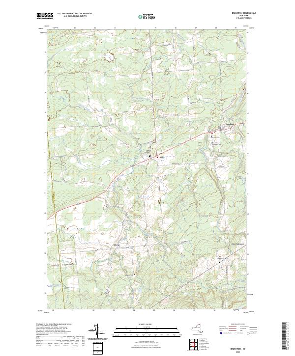
2023 Map of Brushton
USGS Topo · Published 2023About this map
Brushton and Moira serve as the primary hubs of activity in this section of Franklin County, where the Little Salmon River and numerous brooks dictate the rural landscape. The settlement pattern follows a network of historic roads, including Washington St and the Moira - North Lawrence Rd, which link small communities like Alburg and East Dickinson. The terrain is defined by a dense system of wetlands and watercourses, including Farrington Brook and Lawrence Brook, creating a complex hydrography characteristic of this northern region. Genealogists will find significant value in the documentation of several local burial grounds, such as Sunnyside Cem, Saint Peters Cem, and the Moira Community Cem. These sites, along with family-named landmarks like Brigham Hill Rd and John Hill Rd, provide concrete links to the families who established these agricultural and residential outposts near the border of ST Lawrence Co and Franklin Co.
Find a feature on this map
67 named features on this map. Tap any name to fly to it.
Don’t see what you’re looking for? This feature index may not catch every label — zoom into the map to look around manually.
Map Details
Editions of this 2023 Brushton Map
This is the sole edition of this map. No revisions or reprints were ever made.
Other maps of this area

1915 · Malone
USGS Topo · 1:62,500

1915 · Moira
USGS Topo · 1:62,500

1917 · Malone
USGS Topo · 1:62,500

1917 · Moira
USGS Topo · 1:62,500

1919 · Nicholville
USGS Topo · 1:62,500

1921 · Nicholville
USGS Topo · 1:62,500

1921 · Santa Clara
USGS Topo · 1:62,500

1923 · Santa Clara
USGS Topo · 1:62,500

1944 · Moira
USGS Topo · 1:62,500

1948 · Ogdensburg
USGS Topo · 1:250,000