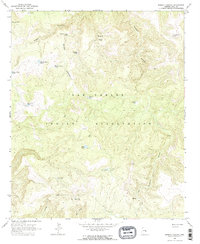
1966 Map of Brushy Canyon
USGS Topo · Published 1967About this map
San Carlos Indian Reservation land dominates this 1960s survey, defined by a complex network of water management features and deep drainage systems. The landscape is characterized by its high-elevation basins and canyons, notably Brushy Canyon and the expansive Sawmill Canyon to the east. These geological features are punctuated by a significant number of stock tanks and improved water sources, which were critical for managing livestock in this arid environment.
Find a feature on this map
23 named features on this map. Tap any name to fly to it.
Don’t see what you’re looking for? This feature index may not catch every label — zoom into the map to look around manually.
Map Details
Editions of this 1966 Brushy Canyon Map
2 editions found
Other maps of this area

1922 · Chrysotile
USGS Topo · 1:125,000

1946 · Blue House Mtn
USGS Topo · 1:62,500

1951 · Blue House Mtn
USGS Topo · 1:62,500

1954 · Mesa
USGS Topo · 1:250,000

1957 · Mesa
USGS Topo · 1:250,000

1958 · Mesa
USGS Topo · 1:250,000

1960 · Mesa
USGS Topo · 1:250,000

1964 · Mesa
USGS Topo · 1:250,000

1966 · Brushy Canyon
USGS Topo · 1:24,000

1966 · Popcorn Canyon
USGS Topo · 1:24,000