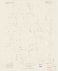
1966 Map of Brushy Mtn
USGS Topo · Published 1969About this map
Bright Ridge and Bald Mountain dominate this Mendocino County landscape, where the terrain is defined by a dense network of high-elevation springs and creek headwaters. The 1960s survey captures a wilderness interface within the Mendocino National Forest, characterized by numerous named water sources like Old Woman Spring and Rackout Spr. The southwestern corner of the sheet is marked by the winding course of the Eel River, which sits below English Ridge Creek and the steep slopes of Box Spring Ridge. Unlike more developed coastal quadrangles, this area relies on a system of primitive routes, including a Footbridge and various unnamed trails and jeep trails that navigate the gaps between Eden Valley and Salt Flat. The map provides an essential record of the interior mountain geography before modern logging or conservation changes altered the local path networks.
Find a feature on this map
37 named features on this map. Tap any name to fly to it.
Don’t see what you’re looking for? This feature index may not catch every label — zoom into the map to look around manually.
Map Details
Editions of this 1966 Brushy Mtn Map
4 editions found
Other maps of this area

1922 · Willits
USGS Topo · 1:62,500

1929 · Eden Valley
USGS Topo · 1:62,500

1942 · Willits
USGS Topo · 1:62,500

1943 · Pomo
USGS Topo · 1:62,500

1944 · Willits
USGS Topo · 1:62,500

1951 · Laytonville
USGS Topo · 1:62,500

1952 · Eden Valley
USGS Topo · 1:62,500

1957 · Ukiah
USGS Topo · 1:250,000

1960 · Ukiah
USGS Topo · 1:250,000

1960 · Potter Valley
USGS Topo · 1:62,500