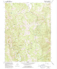
1966 Map of Brushy Mtn
USGS Topo · Published 1994About this map
Eel River winds through the southwestern corner of this Mendocino County landscape, a terrain defined by the high elevations of Bright Ridge and English Ridge. As part of the Mendocino National Forest, the area is characterized by a network of seasonal watercourses and remote springs, including Buckhorn Spring and Rackout Spr. The 1964 aerial survey, updated in the late 1980s, reveals a rugged backcountry where traditional land use is marked by features such as Summer Camp and the isolated Brushy Lake. The naming conventions found here, such as Old Woman Canyon and Deep Hole Valley, suggest a landscape historically tied to localized landmarks and difficult-to-reach pockets of the California Coast Ranges. Geologists and local historians can trace the intricate drainage patterns of Eden Valley Creek and Toney Creek across this sparsely developed mountain territory.
Find a feature on this map
32 named features on this map. Tap any name to fly to it.
Don’t see what you’re looking for? This feature index may not catch every label — zoom into the map to look around manually.
Map Details
Editions of this 1966 Brushy Mtn Map
4 editions found
Other maps of this area

1922 · Willits
USGS Topo · 1:62,500

1929 · Eden Valley
USGS Topo · 1:62,500

1942 · Willits
USGS Topo · 1:62,500

1943 · Pomo
USGS Topo · 1:62,500

1944 · Willits
USGS Topo · 1:62,500

1951 · Laytonville
USGS Topo · 1:62,500

1952 · Eden Valley
USGS Topo · 1:62,500

1957 · Ukiah
USGS Topo · 1:250,000

1960 · Ukiah
USGS Topo · 1:250,000

1960 · Potter Valley
USGS Topo · 1:62,500