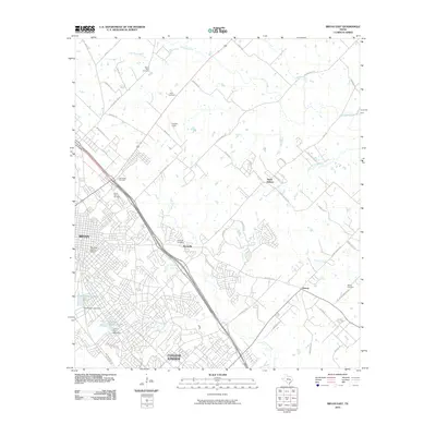
2010 Map of Bryan East
USGS Topo · Published 2010About this map
Bryan and College Station reveal a complex pattern of suburban growth and historical preservation in this 2010 survey. The East Side Historic District highlights the area's established core, while the outlying settlements of Boonville, Steep Hollow, and Harvey show the transition from traditional rural communities to modern residential expansion. The map is a significant resource for genealogists, documenting numerous burial grounds including Boonville Cemetery, Bethel Cemetery, and Mount Calvary Cemetery.
Find a feature on this map
60 named features on this map. Tap any name to fly to it.
Don’t see what you’re looking for? This feature index may not catch every label — zoom into the map to look around manually.
Map Details
Editions of this 2010 Bryan East Map
This is the sole edition of this map. No revisions or reprints were ever made.
Other maps of this area

1931 · Iola
USGS Topo · 1:62,500

1954 · Austin
USGS Topo · 1:250,000

1956 · Bryan
USGS Topo · 1:62,500

1956 · Carlos
USGS Topo · 1:62,500

1959 · Clear Lake
USGS Topo · 1:24,000

1959 · Reliance
USGS Topo · 1:24,000

1959 · Ferguson Crossing
USGS Topo · 1:24,000

1961 · Wellborn
USGS Topo · 1:24,000
1962 · Chances Store
USGS Topo · 1:24,000

1962 · Bryan East
USGS Topo · 1:24,000