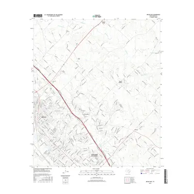
2016 Map of Bryan East
USGS Topo · Published 2016About this map
College Station and the eastern reaches of Bryan anchor this detailed study of Brazos County's urban and rural transition. The landscape is defined by the convergence of several waterways, including Carters Cr and Mathis Cr, which wind through a mix of established residential neighborhoods and outlying agricultural areas. To the east and north, the map reveals smaller settlements like Boonville and Steep Hollow, providing a clear view of the region's historic local geography. Genealogists will find particular value in the documentation of several burial sites, including the Boonville Cem and Mount Calvary Cem. The presence of Coulter Field and various country clubs reflects the mid-20th-century development patterns that shaped this portion of the Texas A&M corridor. The map further documents the rural-to-suburban shift in northern areas like Wixon Valley, where older farm roads intersect with modern residential infrastructure.
Find a feature on this map
284 named features on this map. Tap any name to fly to it.
Don’t see what you’re looking for? This feature index may not catch every label — zoom into the map to look around manually.
Map Details
Editions of this 2016 Bryan East Map
This is the sole edition of this map. No revisions or reprints were ever made.
Other maps of this area

1931 · Iola
USGS Topo · 1:62,500

1954 · Austin
USGS Topo · 1:250,000

1956 · Bryan
USGS Topo · 1:62,500

1956 · Carlos
USGS Topo · 1:62,500

1959 · Clear Lake
USGS Topo · 1:24,000

1959 · Reliance
USGS Topo · 1:24,000

1959 · Ferguson Crossing
USGS Topo · 1:24,000

1961 · Wellborn
USGS Topo · 1:24,000
1962 · Chances Store
USGS Topo · 1:24,000

1962 · Bryan East
USGS Topo · 1:24,000