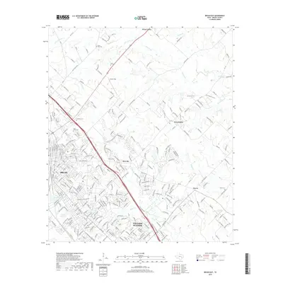
2019 Map of Bryan East
USGS Topo · Published 2019About this map
The expanding urban footprints of Bryan and College Station dominate the southwestern portion of this Brazos County landscape, where residential streets meet established institutions like the Country Club Lake area. This modern survey reflects the rapid growth of the Brazos Valley, showing how historic rural settlements like Boonville and Harvey have been integrated into the suburban fabric. Aviation history is centered at Coulter Field, while the northern reaches of the quadrangle maintain a more open character near Wixon Valley, defined by the winding paths of Wickson Cr and Little Wickson Cr.
Find a feature on this map
294 named features on this map. Tap any name to fly to it.
Don’t see what you’re looking for? This feature index may not catch every label — zoom into the map to look around manually.
Map Details
Editions of this 2019 Bryan East Map
This is the sole edition of this map. No revisions or reprints were ever made.
Other maps of this area

1931 · Iola
USGS Topo · 1:62,500

1954 · Austin
USGS Topo · 1:250,000

1956 · Bryan
USGS Topo · 1:62,500

1956 · Carlos
USGS Topo · 1:62,500

1959 · Clear Lake
USGS Topo · 1:24,000

1959 · Reliance
USGS Topo · 1:24,000

1959 · Ferguson Crossing
USGS Topo · 1:24,000

1961 · Wellborn
USGS Topo · 1:24,000
1962 · Chances Store
USGS Topo · 1:24,000

1962 · Bryan East
USGS Topo · 1:24,000