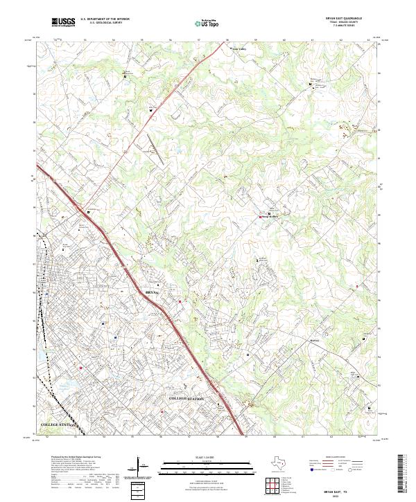
2022 Map of Bryan East
USGS Topo · Published 2022About this map
The expanding urban footprint of Bryan and College Station dominates the southwestern portion of this Brazos County landscape, where modern residential developments meet a heritage of rural cemeteries and creek bottoms. The Union Pacific RR cuts through the historic core near the Brazos County Courthouse, serving as a reminder of the rail-driven growth that established these sister cities. Beyond the city limits, the landscape transitions into the drainage basins of Wickson Cr and Carters Cr, where smaller settlements like Wixon Valley and Harvey maintain a more dispersed character.
Find a feature on this map
302 named features on this map. Tap any name to fly to it.
Don’t see what you’re looking for? This feature index may not catch every label — zoom into the map to look around manually.
Map Details
Editions of this 2022 Bryan East Map
This is the sole edition of this map. No revisions or reprints were ever made.
Other maps of this area

1931 · Iola
USGS Topo · 1:62,500

1954 · Austin
USGS Topo · 1:250,000

1956 · Bryan
USGS Topo · 1:62,500

1956 · Carlos
USGS Topo · 1:62,500

1959 · Clear Lake
USGS Topo · 1:24,000

1959 · Reliance
USGS Topo · 1:24,000

1959 · Ferguson Crossing
USGS Topo · 1:24,000

1961 · Wellborn
USGS Topo · 1:24,000
1962 · Chances Store
USGS Topo · 1:24,000

1962 · Bryan East
USGS Topo · 1:24,000