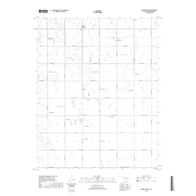
2018 Map of Bryans Corner
USGS Topo · Published 2018About this map
Bryans Corner and Gray anchor this study of north-central Beaver County, depicting a high plains landscape where commerce and community follow a grid of section lines and watercourses. Settlement patterns here are defined by the intersection of rural routes like Trunk Line Rd and several named drainages including Bull Cr and N Fork Clear Cr. For the local historian or genealogist, the map preserves the exact locations of civic landmarks such as Bethel Cem and Gray Cem, providing essential points of reference for the families who settled this part of the Oklahoma Panhandle. The terrain is notably dissected by numerous named hollows, such as Hollow E0280 and Hollow E0310, which dictate the local topography and the flow of seasonal streams like Red Horse Cr and Jackson Cr.
Find a feature on this map
46 named features on this map. Tap any name to fly to it.
Don’t see what you’re looking for? This feature index may not catch every label — zoom into the map to look around manually.
Map Details
Editions of this 2018 Bryans Corner Map
This is the sole edition of this map. No revisions or reprints were ever made.
Other maps of this area

1954 · Perryton
USGS Topo · 1:250,000

1958 · Perryton
USGS Topo · 1:250,000

1973 · Balko
USGS Topo · 1:24,000

1973 · Boyd
USGS Topo · 1:24,000

1973 · Perryton
USGS Topo · 1:24,000

1973 · Bryans Corner SW
USGS Topo · 1:24,000

1973 · Red Horse Creek
USGS Topo · 1:24,000

1973 · Bryans Corner
USGS Topo · 1:24,000

1973 · Balko SW
USGS Topo · 1:24,000

1973 · Huntoon
USGS Topo · 1:24,000