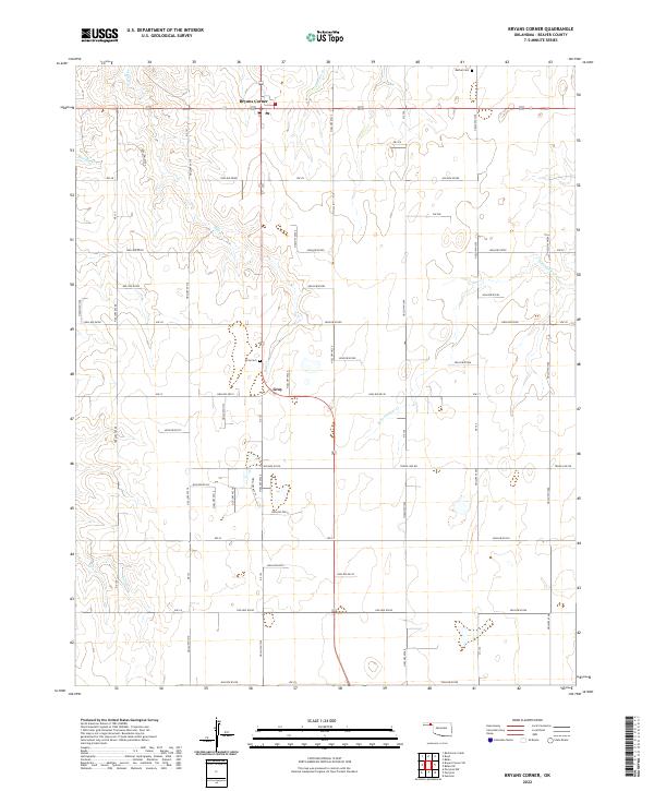
2022 Map of Bryans Corner
USGS Topo · Published 2022About this map
The crossroads of Bryans Corner and the nearby community of Gray anchor this survey of the Oklahoma Panhandle, where the High Plains landscape is etched by a series of intermittent drainages. Waterways like Bull Cr and N Fork Clear Cr define the local topography, carving shallow valleys through the gridded section lines of Beaver County. For those researching local families, the presence of the Bethel Cem and Gray Cem provides essential points of reference for the region’s rural heritage. The map documents a meticulously surveyed road network, including numerous rural routes such as Hollow E0290 and Hollow N1210, which connect the isolated homesteads and ranching tracts that characterize this portion of the Llano Estacado. This level of detail preserves the mid-20th-century settlement pattern of a region where the vast horizon is punctuated only by occasional clusters of buildings and shelterbelts.
Find a feature on this map
59 named features on this map. Tap any name to fly to it.
Don’t see what you’re looking for? This feature index may not catch every label — zoom into the map to look around manually.
Map Details
Editions of this 2022 Bryans Corner Map
This is the sole edition of this map. No revisions or reprints were ever made.
Other maps of this area

1954 · Perryton
USGS Topo · 1:250,000

1958 · Perryton
USGS Topo · 1:250,000

1973 · Balko
USGS Topo · 1:24,000

1973 · Boyd
USGS Topo · 1:24,000

1973 · Perryton
USGS Topo · 1:24,000

1973 · Bryans Corner SW
USGS Topo · 1:24,000

1973 · Red Horse Creek
USGS Topo · 1:24,000

1973 · Bryans Corner
USGS Topo · 1:24,000

1973 · Balko SW
USGS Topo · 1:24,000

1973 · Huntoon
USGS Topo · 1:24,000