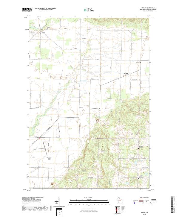
2022 Map of Bryant
USGS Topo · Published 2022About this map
Bryant and Neva anchor this Langlade County landscape, illustrating a classic Wisconsin pattern of small unincorporated communities linked by a dense network of county highways. The area is defined by its transition from agricultural fields in the north and west to the more complex, lake-dotted terrain of the southeast. Notable for family and local historians are the numerous burial grounds, including the Star Neva Cem near the E Br Eau Claire River and the Saint Peters Lutheran Church Cem further south. The southern portion of the map is dominated by the Langlade County Airport and the glacial features surrounding Schmuhl Lake. Drainage patterns are clearly marked by the winding path of Spring Brook, which feeds into the 25 Reservoir, reflecting the water management essential to this rural region.
Find a feature on this map
65 named features on this map. Tap any name to fly to it.
Don’t see what you’re looking for? This feature index may not catch every label — zoom into the map to look around manually.
Map Details
Editions of this 2022 Bryant Map
This is the sole edition of this map. No revisions or reprints were ever made.
Other maps of this area

1942 · Elcho
USGS Topo · 1:48,000

1942 · Pearson
USGS Topo · 1:48,000

1950 · Elcho
USGS Topo · 1:48,000

1950 · Lily
USGS Topo · 1:48,000

1952 · Antigo
USGS Topo · 1:48,000

1952 · White Lake
USGS Topo · 1:48,000

1954 · Iron Mountain
USGS Topo · 1:250,000

1959 · Iron Mountain
USGS Topo · 1:250,000
1973 · Antigo
USGS Topo · 1:24,000
1973 · Bryant
USGS Topo · 1:24,000