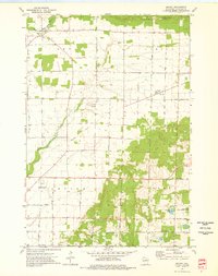
1973 Map of Bryant
USGS Topo · Published 1976About this map
Bryant serves as a central hub for this rural Langlade County landscape, which is defined by a grid of farm-to-market roads and the legacies of early transport. An Old Railroad Grade cuts across the township of Price, marking the path of former timber or freight lines that once fueled the local economy. To the west, the Eau Claire River and Spring Brook wind through the township of Neva, while the southern reaches near Polar feature a more densely wooded environment and the conservation lands of the Rabe Lake State Fishery Area.
Find a feature on this map
36 named features on this map. Tap any name to fly to it.
Don’t see what you’re looking for? This feature index may not catch every label — zoom into the map to look around manually.
Map Details
Editions of this 1973 Bryant Map
This is the sole edition of this map. No revisions or reprints were ever made.
Other maps of this area

1942 · Elcho
USGS Topo · 1:48,000

1942 · Pearson
USGS Topo · 1:48,000

1950 · Elcho
USGS Topo · 1:48,000

1950 · Lily
USGS Topo · 1:48,000

1952 · Antigo
USGS Topo · 1:48,000

1952 · White Lake
USGS Topo · 1:48,000

1954 · Iron Mountain
USGS Topo · 1:250,000

1959 · Iron Mountain
USGS Topo · 1:250,000
1973 · Antigo
USGS Topo · 1:24,000
1973 · Aniwa
USGS Topo · 1:24,000