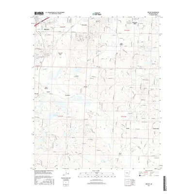
2017 Map of Bryant
USGS Topo · Published 2017About this map
Bryant and the surrounding Saline County landscape are defined by a complex network of creeks and small communities transitioning from rural roots to suburban expansion. The topography is marked by notable elevations such as Alexander Mtn, while the hydrology is dominated by the winding paths of Hurricane Cr and Crooked Cr. Local history is preserved in numerous burial grounds, including the China Grove Cemeteries and Alexander Cem, which anchor the area's genealogical record. Industrial and infrastructure landmarks are prominent, from the mining history suggested by Bauxite in the southwest to the Saline County Regional Airport. Small named locales like Vimy Ridge, Shannon Hills, and Sardis illustrate the decentralized settlement pattern of the region. Water bodies such as Indian Springs Lake and Old Brown Mud Lakes highlight the varied wetland and drainage systems that have shaped land use across these townships.
Find a feature on this map
87 named features on this map. Tap any name to fly to it.
Don’t see what you’re looking for? This feature index may not catch every label — zoom into the map to look around manually.
Map Details
Editions of this 2017 Bryant Map
This is the sole edition of this map. No revisions or reprints were ever made.
Other maps of this area

1890 · Benton
USGS Topo · 1:125,000

1891 · Little Rock
USGS Topo · 1:125,000

1893 · Little Rock
USGS Topo · 1:125,000

1894 · Benton
USGS Topo · 1:125,000

1935 · Little Rock
USGS Topo · 1:24,000

1935 · Alexander
USGS Topo · 1:48,000

1938 · Benton
USGS Topo · 1:48,000

1941 · Alexander
USGS Topo · 1:62,500

1944 · Benton
USGS Topo · 1:62,500

1944 · Alexander
USGS Topo · 1:31,680