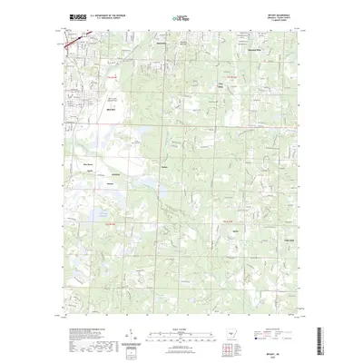
2023 Map of Bryant
USGS Topo · Published 2023About this map
Industrial history and suburban growth converge in this Saline County landscape, where the legacy of mineral extraction is visible through settlements like Bauxite and Lignite. The presence of the Old Brown Mud Lakes south of Bryant indicates the region's long-standing connection to aluminum and coal production. In the northern reaches, Alexander Mountain overlooks the community of Alexander, while the Saline County Regional Airport anchors the central transport corridor. Local history is preserved in numerous burial sites, including the China Grove Cem and McPherson Cem. The drainage patterns of Hurricane Creek and its many tributaries, such as Briar Lick Branch and Emory Branch, define the low-lying areas between established neighborhoods like Shannon Hills and Sardis. This map documents a modern transition as traditional mining grounds and rural outposts like Pine Haven integrate into the expanding footprint of the capital region.
Find a feature on this map
157 named features on this map. Tap any name to fly to it.
Don’t see what you’re looking for? This feature index may not catch every label — zoom into the map to look around manually.
Map Details
Editions of this 2023 Bryant Map
This is the sole edition of this map. No revisions or reprints were ever made.
Other maps of this area

1890 · Benton
USGS Topo · 1:125,000

1891 · Little Rock
USGS Topo · 1:125,000

1893 · Little Rock
USGS Topo · 1:125,000

1894 · Benton
USGS Topo · 1:125,000

1935 · Little Rock
USGS Topo · 1:24,000

1935 · Alexander
USGS Topo · 1:48,000

1938 · Benton
USGS Topo · 1:48,000

1941 · Alexander
USGS Topo · 1:62,500

1944 · Benton
USGS Topo · 1:62,500

1944 · Alexander
USGS Topo · 1:31,680