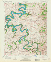
1952 Map of Bryantsville
USGS Topo · Published 1967About this map
Herrington Lake dominates the central landscape of this Kentucky survey, its serpentine waters filling the deep gorges of the Dix River. The terrain is defined by the sharp boundaries where Garrard, Boyle, Mercer, and Lincoln counties meet at the river's edge. This 1952 field check documents the rural transition as the Wilderness Trail cuts through the southern portion of the sheet near Clarks Run. Settlement clusters such as Bryantsville and Davistown are anchored by local institutions like Mt Olivet Ch and Pleasant Grove Ch. The presence of the State Hospital and Camp Dick Robinson points to the significant public and historical footprint in the region. Notable landmarks like Burdette Knob and river features such as Dunn Island and Gwins Island illustrate a landscape shaped by both geological forces and early Kentucky transit routes.
Find a feature on this map
45 named features on this map. Tap any name to fly to it.
Don’t see what you’re looking for? This feature index may not catch every label — zoom into the map to look around manually.
Map Details
Editions of this 1952 Bryantsville Map
3 editions found
Other maps of this area

1905 · Harrodsburg
USGS Topo · 1:125,000

1950 · Bryantsville
USGS Topo · 1:24,000

1952 · Little Hickman
USGS Topo · 1:24,000

1952 · Buckeye
USGS Topo · 1:24,000

1952 · Danville
USGS Topo · 1:24,000

1952 · Harrodsburg
USGS Topo · 1:24,000

1952 · Lancaster
USGS Topo · 1:24,000

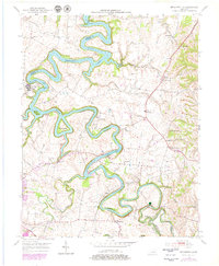
1952 · Bryantsville
USGS Topo · 1:24,000

1952 · Stanford
USGS Topo · 1:24,000
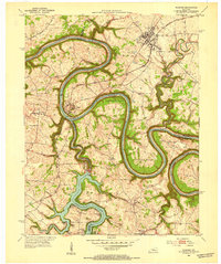
1952 · Wilmore
USGS Topo · 1:24,000