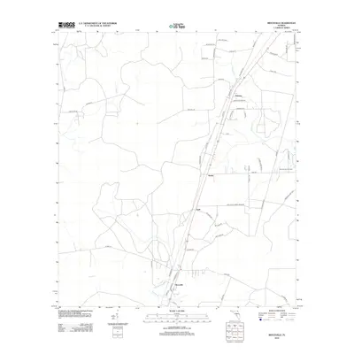
2012 Map of Bryceville
USGS Topo · Published 2012About this map
Bryceville anchors the southern portion of this Nassau County landscape, where the rail-and-road corridor defines the local geography. Small settlements including Dahoma, Verdie, and Ingle are spaced along the primary transportation spine, reflecting the rural development patterns of the early 21st century. The terrain is characterized by low-lying drainages, most notably Brandy Br, Deep Cr, and Thomas Cr, which wind through the timberlands and rural residential plots.
Find a feature on this map
54 named features on this map. Tap any name to fly to it.
Don’t see what you’re looking for? This feature index may not catch every label — zoom into the map to look around manually.
Map Details
Editions of this 2012 Bryceville Map
This is the sole edition of this map. No revisions or reprints were ever made.
Other maps of this area

1917 · Cambon
USGS Topo · 1:62,500

1917 · Macclenny
USGS Topo · 1:62,500

1917 · Hilliard
USGS Topo · 1:62,500

1918 · Moniac
USGS Topo · 1:62,500

1918 · Cambon
USGS Topo · 1:62,500

1918 · Macclenny
USGS Topo · 1:62,500

1919 · Hilliard
USGS Topo · 1:62,500

1942 · Moniac
USGS Topo · 1:62,500

1948 · Jacksonville
USGS Topo · 1:250,000

1954 · Valdosta
USGS Topo · 1:250,000