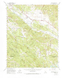
1961 Map of Bryson
USGS Topo · Published 1968About this map
The Hunter Liggett Military Reservation dominates the northern and central landscape of this survey, encompassing diverse terrain from the San Antonio River valley to the heights of the Santa Lucia Range. This 1960s snapshot shows a region transitionally balanced between military operations and rural California life. Small agricultural and civic hubs like Jolon, Lockwood, and Bryson are visible, serving as anchors for the local community alongside features like the San Antonio Union Sch.
Find a feature on this map
84 named features on this map. Tap any name to fly to it.
Don’t see what you’re looking for? This feature index may not catch every label — zoom into the map to look around manually.
Map Details
Editions of this 1961 Bryson Map
This is the sole edition of this map. No revisions or reprints were ever made.
Other maps of this area

1912 · San Ardo
USGS Topo · 1:31,680

1915 · Priest Valley
USGS Topo · 1:125,000

1919 · King City
USGS Topo · 1:62,500

1919 · Junipero Serra
USGS Topo · 1:62,500

1919 · Bryson
USGS Topo · 1:62,500

1919 · Bradley
USGS Topo · 1:62,500

1919 · Adelaida
USGS Topo · 1:62,500

1919 · Piedras Blancas
USGS Topo · 1:62,500

1919 · San Simeon
USGS Topo · 1:62,500

1921 · Cape San Martin
USGS Topo · 1:62,500