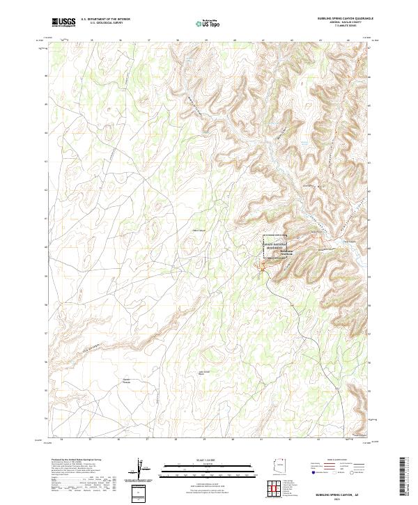
2021 Map of Bubbling Spring Canyon
USGS Topo · Published 2021About this map
Navajo National Monument centers this high-desert landscape, preserving significant archaeological sites in the canyon systems north of the Shonto Plateau. The terrain is defined by a series of deep drainages, including Keet Seel Canyon, Dowozhiebito Canyon, and Tsegi Canyon, which converge around Tsegi Point. These canyons intersect with the expansive Skeleton Mesa, a dominant plateau feature that dictates the local geography.
Find a feature on this map
30 named features on this map. Tap any name to fly to it.
Don’t see what you’re looking for? This feature index may not catch every label — zoom into the map to look around manually.
Map Details
Editions of this 2021 Bubbling Spring Canyon Map
This is the sole edition of this map. No revisions or reprints were ever made.
Other maps of this area

1883 · Marsh Pass
USGS Topo · 1:250,000

1892 · Marsh Pass
USGS Topo · 1:250,000

1952 · Agathla Peak 2 SW
USGS Topo · 1:24,000

1952 · Boot Mesa
USGS Topo · 1:62,500

1956 · Marble Canyon
USGS Topo · 1:250,000

1959 · Marble Canyon
USGS Topo · 1:250,000

1961 · Marble Canyon
USGS Topo · 1:250,000

1968 · Marsh Pass
USGS Topo · 1:24,000

1970 · Shonto SE
USGS Topo · 1:24,000
1970 · Betatakin Ruin
USGS Topo · 1:24,000