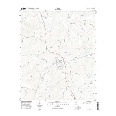
2014 Map of Buchanan
USGS Topo · Published 2014About this map
The Tallapoosa River flows across this Haralson County landscape, anchoring a rural network of small communities and family-named landmarks. Near the northern reach of the river sits Abernathys Mill, while the central portion of the sheet is dominated by the town of Buchanan, where the Buchanan City Cem is a prominent local landmark. The terrain is defined by its watercourses, including Little River, Cochran Cr, and Holcomb Cr, which drain the wooded hillsides surrounding the town center.
Find a feature on this map
124 named features on this map. Tap any name to fly to it.
Don’t see what you’re looking for? This feature index may not catch every label — zoom into the map to look around manually.
Map Details
Editions of this 2014 Buchanan Map
This is the sole edition of this map. No revisions or reprints were ever made.
Other maps of this area

1889 · Tallapoosa
USGS Topo · 1:125,000

1892 · Tallapoosa
USGS Topo · 1:125,000

1897 · Tallapoosa
USGS Topo · 1:125,000

1953 · Atlanta
USGS Topo · 1:250,000

1957 · Atlanta
USGS Topo · 1:250,000

1958 · Atlanta
USGS Topo · 1:250,000

1958 · Carrollton
USGS Topo · 1:62,500

1958 · Buchanan
USGS Topo · 1:62,500

1965 · Tallapoosa South
USGS Topo · 1:24,000

1966 · Tallapoosa North
USGS Topo · 1:24,000