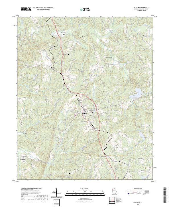
2024 Map of Buchanan
USGS Topo · Published 2024About this map
Buchanan serves as the seat of Haralson County, anchored by the Haralson County Courthouse and its surrounding street grid. This part of Georgia is defined by a dense network of creeks, such as Cochran Creek, Little River, and Harris Creek, which feed into the Tallapoosa River in the northeast. The landscape is dotted with small-scale industrial and community markers, including Abernathys Mill and numerous rural cemeteries that indicate long-standing family settlements. To the south, the terrain transitions toward the fringes of Tallapoosa and West Bremen. Significant water bodies like Lake Olympia, Lake Haralson, and Baxter Lake are prominent landmarks in the eastern and southern reaches. The road network connects outlying areas like Abernathys Mill to the central hub, reflecting the region's historical reliance on local milling and agriculture within the Piedmont terrain.
Find a feature on this map
125 named features on this map. Tap any name to fly to it.
Don’t see what you’re looking for? This feature index may not catch every label — zoom into the map to look around manually.
Map Details
Editions of this 2024 Buchanan Map
This is the sole edition of this map. No revisions or reprints were ever made.
Other maps of this area

1889 · Tallapoosa
USGS Topo · 1:125,000

1892 · Tallapoosa
USGS Topo · 1:125,000

1897 · Tallapoosa
USGS Topo · 1:125,000

1953 · Atlanta
USGS Topo · 1:250,000

1957 · Atlanta
USGS Topo · 1:250,000

1958 · Atlanta
USGS Topo · 1:250,000

1958 · Carrollton
USGS Topo · 1:62,500

1958 · Buchanan
USGS Topo · 1:62,500

1965 · Tallapoosa South
USGS Topo · 1:24,000

1966 · Tallapoosa North
USGS Topo · 1:24,000