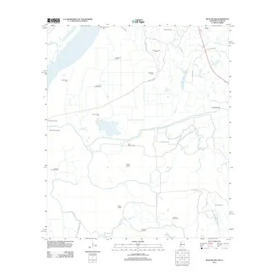
2012 Map of Buck Island
USGS Topo · Published 2012About this map
Extensive industrial oil extraction defines the landscape of Adams County, Mississippi, along the eastern banks of the Mississippi River. This survey captures a terrain heavily marked by petroleum production, featuring numerous active zones such as the Hutchins Landing Oil Field, Sibley Oil Field, and Shieldsboro Oil Field. The natural hydrology of the area is complex, with the Homochitto River and its various distributaries like Tom Bayou and Running Bayou winding through the alluvial plains. Large landmasses formed by these shifting watercourses, notably Buck Island and Tansey Island, are prominent landmarks south of the Armstrong Canal. The local road network, including Shepherd Rd and Will Washington Rd, provides access to these remote production sites. This map serves as a detailed record of the region's energy economy and the intricate wetlands surrounding Gilliard Lake and Becks Bay.
Find a feature on this map
43 named features on this map. Tap any name to fly to it.
Don’t see what you’re looking for? This feature index may not catch every label — zoom into the map to look around manually.
Map Details
Editions of this 2012 Buck Island Map
This is the sole edition of this map. No revisions or reprints were ever made.
Other maps of this area

1936 · Woodville
USGS Topo · 1:62,500

1939 · Kingston
USGS Topo · 1:62,500

1939 · Artonish
USGS Topo · 1:62,500

1939 · Deer Park
USGS Topo · 1:62,500

1953 · Natchez
USGS Topo · 1:250,000

1954 · Artonish
USGS Topo · 1:62,500

1955 · Artonish
USGS Topo · 1:62,500

1956 · Natchez
USGS Topo · 1:250,000

1958 · Artonish
USGS Topo · 1:62,500

1958 · Woodville
USGS Topo · 1:62,500