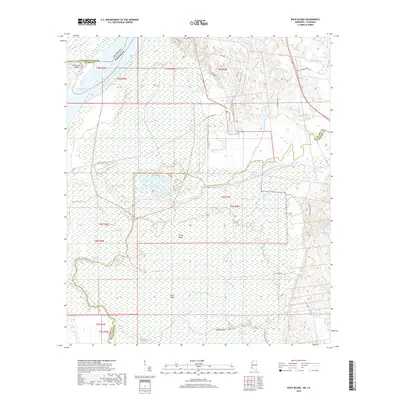
2018 Map of Buck Island
USGS Topo · Published 2018About this map
Mississippi River dynamics dominate this low-lying borderland between Adams County, Mississippi, and Concordia Parish, Louisiana. The landscape is defined by its complex hydrography, where the Glasscock Cutoff has altered the main channel's flow, leaving behind features like Glasscock Point. Inland from the river, a sprawling network of wetlands and seasonal waterways characterizes the terrain, including Gaillards Lake, Lake Lucille, and the extensive Belmont Slough.
Find a feature on this map
42 named features on this map. Tap any name to fly to it.
Don’t see what you’re looking for? This feature index may not catch every label — zoom into the map to look around manually.
Map Details
Editions of this 2018 Buck Island Map
This is the sole edition of this map. No revisions or reprints were ever made.
Other maps of this area

1936 · Woodville
USGS Topo · 1:62,500

1939 · Kingston
USGS Topo · 1:62,500

1939 · Artonish
USGS Topo · 1:62,500

1939 · Deer Park
USGS Topo · 1:62,500

1953 · Natchez
USGS Topo · 1:250,000

1954 · Artonish
USGS Topo · 1:62,500

1955 · Artonish
USGS Topo · 1:62,500

1956 · Natchez
USGS Topo · 1:250,000

1958 · Artonish
USGS Topo · 1:62,500

1958 · Woodville
USGS Topo · 1:62,500