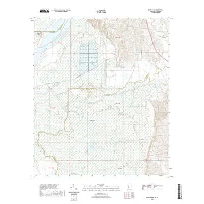
2020 Map of Buck Island
USGS Topo · Published 2020About this map
Mississippi River alluvial plains and intricate wetlands dominate this landscape along the border of Adams County and Concordia Parish. The hydrological patterns here are defined by the Homochitto River, which meanders through the marshy terrain to meet the great river, creating a complex network of waterways including Mud Flats Bayou, Running Bayou, and Coles Bayou. Significant landforms such as Tansey Island and Buck Island emerge from the seasonally flooded bottomlands, illustrating the dynamic nature of the river's course.
Find a feature on this map
37 named features on this map. Tap any name to fly to it.
Don’t see what you’re looking for? This feature index may not catch every label — zoom into the map to look around manually.
Map Details
Editions of this 2020 Buck Island Map
This is the sole edition of this map. No revisions or reprints were ever made.
Other maps of this area

1936 · Woodville
USGS Topo · 1:62,500

1939 · Kingston
USGS Topo · 1:62,500

1939 · Artonish
USGS Topo · 1:62,500

1939 · Deer Park
USGS Topo · 1:62,500

1953 · Natchez
USGS Topo · 1:250,000

1954 · Artonish
USGS Topo · 1:62,500

1955 · Artonish
USGS Topo · 1:62,500

1956 · Natchez
USGS Topo · 1:250,000

1958 · Artonish
USGS Topo · 1:62,500

1958 · Woodville
USGS Topo · 1:62,500