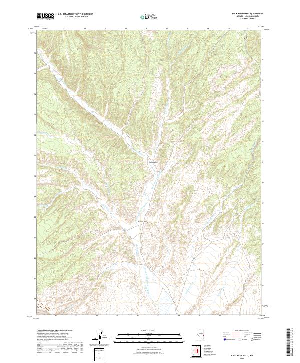
2021 Map of Buck Wash Well
USGS Topo · Published 2021About this map
Camp Valley serves as the central focal point for this section of Lincoln County, where the high desert terrain is defined by an intricate network of drainage systems. The landscape is dominated by the broad Meadow Valley Wash and its many tributaries, including the E Fork Spring Valley Wash and Buck Wash. These ephemeral watercourses illustrate the complex hydrologic patterns of the region, where seasonal runoff has carved distinct paths like Bowling Wash and White Rock Wash through the alluvial fans. The distribution of these washes suggests the natural corridors used for movement and grazing in the eastern Nevada backcountry. Smaller features like Buster Wash and Coyote Wash branch off from the primary valleys, providing a detailed look at the watershed geography that has influenced land use and ranching boundaries in this part of the state.
Find a feature on this map
13 named features on this map. Tap any name to fly to it.
Don’t see what you’re looking for? This feature index may not catch every label — zoom into the map to look around manually.
Map Details
Editions of this 2021 Buck Wash Well Map
This is the sole edition of this map. No revisions or reprints were ever made.
Other maps of this area

1956 · Lund
USGS Topo · 1:250,000

1960 · Lund
USGS Topo · 1:250,000

1970 · Pierson Summit
USGS Topo · 1:24,000

1970 · Parsnip Peak
USGS Topo · 1:24,000

1972 · Gleason Basin
USGS Topo · 1:24,000

1972 · White Rock Peak
USGS Topo · 1:24,000
1972 · Rice Mountain
USGS Topo · 1:24,000

1972 · Buck Wash Well
USGS Topo · 1:24,000
1972 · Eagle Valley Reservoir
USGS Topo · 1:24,000

1972 · Miller Canyon
USGS Topo · 1:24,000