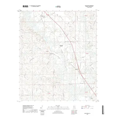
2018 Map of Buckatunna
USGS Topo · Published 2018About this map
Buckatunna and Chicora anchor this rural landscape in Wayne County, where the meandering path of the Chickasawhay River and its numerous tributaries define the local geography. The map reveals a settlement pattern tied to traditional transportation corridors, including the path of Old 45 Winchester Rd and the central hub at Robinsons Junction. For genealogists and local historians, the sheet is a significant resource for locating family burial grounds such as Winchester Cem, Mills Cem, and Mount Zion Cem, which are scattered throughout the wooded terrain. Numerous waterways like Beaver Cr and Patrick Cr crisscross the land, illustrating the dense network of creeks that supported the area's early development. At the southern edge, the small community of Battles sits near Mongus Cr, while to the north, the historic area of Winchester remains a focal point near the banks of Meadows Mill Cr.
Find a feature on this map
76 named features on this map. Tap any name to fly to it.
Don’t see what you’re looking for? This feature index may not catch every label — zoom into the map to look around manually.
Map Details
Editions of this 2018 Buckatunna Map
This is the sole edition of this map. No revisions or reprints were ever made.
Other maps of this area

1953 · Hattiesburg
USGS Topo · 1:250,000

1958 · Hattiesburg
USGS Topo · 1:250,000

1964 · Denham
USGS Topo · 1:24,000

1964 · Knobtown
USGS Topo · 1:24,000

1964 · Clara
USGS Topo · 1:24,000

1964 · Waynesboro
USGS Topo · 1:24,000

1964 · Buckatunna
USGS Topo · 1:24,000

1964 · Piave
USGS Topo · 1:24,000

1974 · State Line
USGS Topo · 1:24,000

1974 · Copeland
USGS Topo · 1:24,000