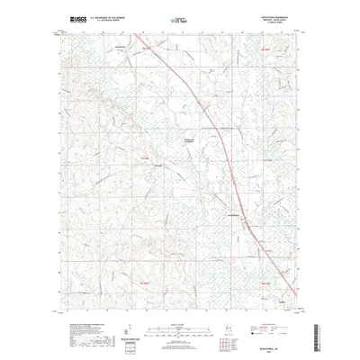
2020 Map of Buckatunna
USGS Topo · Published 2020About this map
The Chickasawhay River meanders south through this corner of Wayne County, forming a natural corridor for settlements such as Winchester and Chicora. This modern topographical study reveals a landscape defined by its waterways and small, interconnected communities. Further south, the map details the layout of Buckatunna and the small hamlet of Battles near the county line. The drainage patterns of Buckatunna Creek and its many tributaries, including Winchester Mill Cr and Brewers Cr, highlight the low-lying terrain surrounding these rural centers.
Find a feature on this map
71 named features on this map. Tap any name to fly to it.
Don’t see what you’re looking for? This feature index may not catch every label — zoom into the map to look around manually.
Map Details
Editions of this 2020 Buckatunna Map
This is the sole edition of this map. No revisions or reprints were ever made.
Other maps of this area

1953 · Hattiesburg
USGS Topo · 1:250,000

1958 · Hattiesburg
USGS Topo · 1:250,000

1964 · Denham
USGS Topo · 1:24,000

1964 · Knobtown
USGS Topo · 1:24,000

1964 · Clara
USGS Topo · 1:24,000

1964 · Waynesboro
USGS Topo · 1:24,000

1964 · Buckatunna
USGS Topo · 1:24,000

1964 · Piave
USGS Topo · 1:24,000

1974 · State Line
USGS Topo · 1:24,000

1974 · Copeland
USGS Topo · 1:24,000