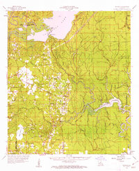
1959 Map of Buckeye
USGS Topo · Published 1962About this map
Catahoula Lake dominates the northern landscape of this late 1950s survey, marking a complex watery environment where the borders of LaSalle, Grant, and Rapides parishes meet. The area is characterized by an intricate network of waterways like Big Bayou and French Fork, which once supported the local river economy before the proliferation of the petroleum industry. Evidence of this shift is visible in the North Saline Lake Oil Field and scattered oil wells that punctuate the traditional agricultural prairie lands.
Find a feature on this map
89 named features on this map. Tap any name to fly to it.
Don’t see what you’re looking for? This feature index may not catch every label — zoom into the map to look around manually.
Map Details
Editions of this 1959 Buckeye Map
2 editions found

Other maps of this area

1935 · Tooleys
USGS Topo · 1:62,500

1935 · Lecompte
USGS Topo · 1:62,500

1936 · Pollock
USGS Topo · 1:62,500

1940 · Marksville
USGS Topo · 1:62,500

1941 · Manifest
USGS Topo · 1:62,500

1941 · Jena
USGS Topo · 1:62,500

1941 · Voorhies
USGS Topo · 1:62,500

1941 · Alexandria
USGS Topo · 1:62,500

1941 · Buckeye
USGS Topo · 1:62,500

1941 · Pollock
USGS Topo · 1:62,500