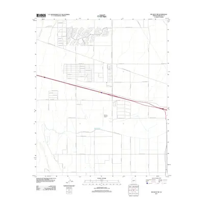
2011 Map of Buckeye NW
USGS Topo · Published 2011About this map
The Hassayampa River corridor defines the western edge of this Arizona landscape, showing a transition from the river's path into the expanding infrastructure of western Maricopa County. Aviation interests are centered at the Buckeye Municipal Airport, a focal point for regional transport and local development. The map reveals an organized grid of thoroughfares, including historic routes like W Van Buren St and W Indian School Rd, which coordinate with irrigation features such as the Roosevelt Canal. This layout reflects the area's agricultural foundation and its 21st-century residential growth. The intersection of desert hydrology and modern engineering is evident where the canal system crosses the landscape, providing essential water resources to the plains east of the river valley.
Find a feature on this map
55 named features on this map. Tap any name to fly to it.
Don’t see what you’re looking for? This feature index may not catch every label — zoom into the map to look around manually.
Map Details
Editions of this 2011 Buckeye NW Map
This is the sole edition of this map. No revisions or reprints were ever made.
Other maps of this area

1954 · Phoenix
USGS Topo · 1:250,000

1957 · Phoenix
USGS Topo · 1:250,000

1957 · White Tank Mts. SE
USGS Topo · 1:24,000

1957 · Valencia
USGS Topo · 1:24,000

1957 · White Tank Mts.
USGS Topo · 1:62,500

1958 · Phoenix
USGS Topo · 1:250,000

1958 · Buckeye NW
USGS Topo · 1:24,000

1958 · Hassayampa
USGS Topo · 1:24,000

1958 · Buckeye
USGS Topo · 1:24,000

1958 · Buckeye
USGS Topo · 1:62,500