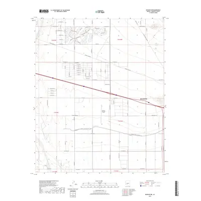
2018 Map of Buckeye NW
USGS Topo · Published 2018About this map
Buckeye anchors the eastern edge of this western Maricopa County landscape, where the edge of suburban development meets the agricultural and desert plains of the Salt River Valley. The map documents a complex water management system essential for desert habitation, notably the Roosevelt Canal and the Roosevelt Irrigation District CSR, which traverse the southern half of the quadrangle. These irrigation routes define the layout of the local road grid, including long thoroughfares like Indian School Rd and W Buckeye Rd. To the west, the arid bed of the Hassayampa River borders the territory, while the Buckeye Municipal Airport stands as a central landmark amidst the transition from organized street blocks to open desert. The presence of the Tonopah Salome Hwy cutting across the north highlights the area's role as a transit corridor connecting the Phoenix metropolitan fringe with the deeper desert reaches.
Find a feature on this map
96 named features on this map. Tap any name to fly to it.
Don’t see what you’re looking for? This feature index may not catch every label — zoom into the map to look around manually.
Map Details
Editions of this 2018 Buckeye NW Map
This is the sole edition of this map. No revisions or reprints were ever made.
Other maps of this area

1954 · Phoenix
USGS Topo · 1:250,000

1957 · Phoenix
USGS Topo · 1:250,000

1957 · White Tank Mts. SE
USGS Topo · 1:24,000

1957 · Valencia
USGS Topo · 1:24,000

1957 · White Tank Mts.
USGS Topo · 1:62,500

1958 · Phoenix
USGS Topo · 1:250,000

1958 · Buckeye NW
USGS Topo · 1:24,000

1958 · Hassayampa
USGS Topo · 1:24,000

1958 · Buckeye
USGS Topo · 1:24,000

1958 · Buckeye
USGS Topo · 1:62,500