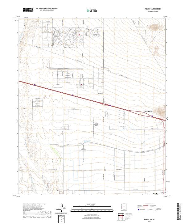
2021 Map of Buckeye NW
USGS Topo · Published 2021About this map
Agricultural infrastructure and modern aviation intersect in this Maricopa County landscape near Buckeye. The central feature of the area's development is the extensive water management network, anchored by the Roosevelt Canal and the Roosevelt Irrigation District CSR, which draw from regional water sources to support the arid valley. The Hassayampa River defines the western edge of the quadrangle, illustrating the natural drainage patterns that have shaped local settlement. Transportation corridors like the Tonopah Salome Hwy and W Buckeye Rd facilitate movement across the grid, while the Buckeye Municipal Airport serves as a significant regional landmark and logistical hub. Residential and commercial growth is evident along the northern street grid, with established routes such as Indian School Rd and W Thomas Rd connecting the area to the broader metropolitan sprawl.
Find a feature on this map
97 named features on this map. Tap any name to fly to it.
Don’t see what you’re looking for? This feature index may not catch every label — zoom into the map to look around manually.
Map Details
Editions of this 2021 Buckeye NW Map
This is the sole edition of this map. No revisions or reprints were ever made.
Other maps of this area

1954 · Phoenix
USGS Topo · 1:250,000

1957 · Phoenix
USGS Topo · 1:250,000

1957 · White Tank Mts. SE
USGS Topo · 1:24,000

1957 · Valencia
USGS Topo · 1:24,000

1957 · White Tank Mts.
USGS Topo · 1:62,500

1958 · Phoenix
USGS Topo · 1:250,000

1958 · Buckeye NW
USGS Topo · 1:24,000

1958 · Hassayampa
USGS Topo · 1:24,000

1958 · Buckeye
USGS Topo · 1:24,000

1958 · Buckeye
USGS Topo · 1:62,500