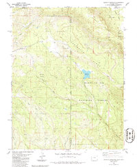
1986 Map of Buckeye Reservoir
USGS Topo · Published 1986About this map
Buckeye Reservoir serves as a central landmark in this high-desert landscape, situated where the Manti-La Sal National Forest meets the state line. The topography is defined by significant elevation changes, from the broad expanse of Pine Flat to the dramatic depression of Sinbad Valley, which is flanked by the towering Sinbad Ridge. This area shows the intersection of several county jurisdictions, including Grand, San Juan, and Montrose counties.
Find a feature on this map
26 named features on this map. Tap any name to fly to it.
Don’t see what you’re looking for? This feature index may not catch every label — zoom into the map to look around manually.
Map Details
Editions of this 1986 Buckeye Reservoir Map
This is the sole edition of this map. No revisions or reprints were ever made.
Other maps of this area

1885 · La Sal
USGS Topo · 1:250,000

1916 · Paradox Valley
USGS Topo · 1:125,000

1922 · Paradox Valley
USGS Topo · 1:125,000

1948 · Roc Creek
USGS Topo · 1:24,000

1948 · Paradox
USGS Topo · 1:24,000

1949 · Paradox
USGS Topo · 1:24,000

1949 · Roc Creek
USGS Topo · 1:24,000

1949 · Juanita Arch
USGS Topo · 1:24,000

1950 · Juanita Arch
USGS Topo · 1:24,000

1954 · Mt Peale 1 SE
USGS Topo · 1:24,000