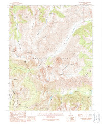
1990 Map of Buckeye Ridge
USGS Topo · Published 1990About this map
Toiyabe National Forest and the high alpine environments of the Sierra Nevada dominate this 1990 survey, where the boundary between Mono Co and Tuolumne Co follows the crest of the range. The landscape is defined by massive glacial features, including the broad Hanging Valley and the sharp relief of Flatiron Ridge. Water moves through this high country via Buckeye Creek and Robinson Creek, eventually reaching Twin Lakes at the edge of the quadrangle.
Find a feature on this map
40 named features on this map. Tap any name to fly to it.
Don’t see what you’re looking for? This feature index may not catch every label — zoom into the map to look around manually.
Map Details
Editions of this 1990 Buckeye Ridge Map
2 editions found
Other maps of this area

1896 · Dardanelles
USGS Topo · 1:125,000

1898 · Dardanelles
USGS Topo · 1:125,000

1909 · Bridgeport
USGS Topo · 1:125,000

1911 · Bridgeport
USGS Topo · 1:125,000

1920 · Bridgeport
USGS Topo · 1:125,000

1948 · Walker Lake
USGS Topo · 1:250,000

1954 · Pickel Meadow
USGS Topo · 1:24,000

1954 · Fales Hot Springs
USGS Topo · 1:24,000

1956 · Sonora Pass
USGS Topo · 1:62,500

1956 · Fales Hot Springs
USGS Topo · 1:62,500