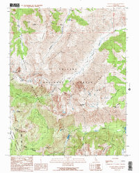
1990 Map of Buckeye Ridge
USGS Topo · Published 1990About this map
The High Sierra divide at the junction of Mono and Tuolumne Counties is defined by the intersections of the Hoover Wilderness, Toiyabe National Forest, and the northeastern corner of Yosemite National Park. This 1990 provisional survey documents a high-altitude landscape of steep ridgelines and glacial basins, where Buckeye Creek and Robinson Creek drain the eastern slopes toward the Great Basin. Significant peaks such as Hunewill Peak, Eagle Peak, and Victoria Peak dominate the skyline, while the transition from granite summits to alpine lakes is marked by McMillan Lake, Barney Lake, and Little Lake. The presence of the McMillan Cabin and numerous pack trails indicates a region utilized for seasonal livestock grazing and remote back-country access. Evidence of the area's hydrology is visible in the descent of Horsetail Falls and the headwaters of Blacksmith Creek and Eagle Creek.
Find a feature on this map
46 named features on this map. Tap any name to fly to it.
Don’t see what you’re looking for? This feature index may not catch every label — zoom into the map to look around manually.
Map Details
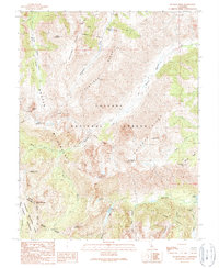
Editions of this 1990 Buckeye Ridge Map
2 editions found
Other maps of this area

1896 · Dardanelles
USGS Topo · 1:125,000

1898 · Dardanelles
USGS Topo · 1:125,000

1909 · Bridgeport
USGS Topo · 1:125,000

1911 · Bridgeport
USGS Topo · 1:125,000

1920 · Bridgeport
USGS Topo · 1:125,000

1948 · Walker Lake
USGS Topo · 1:250,000

1954 · Pickel Meadow
USGS Topo · 1:24,000

1954 · Fales Hot Springs
USGS Topo · 1:24,000

1956 · Sonora Pass
USGS Topo · 1:62,500

1956 · Fales Hot Springs
USGS Topo · 1:62,500