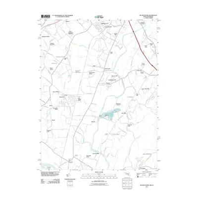
2011 Map of Buckeystown
USGS Topo · Published 2011About this map
The Monocacy River winds through the heart of this landscape, separating the residential expansions of Ballenger Creek and Country Side from the agricultural and industrial sites to the south. Near the center, the community of Buckeystown serves as a historic focal point, marked by its Buckeystown Post Office and the nearby Lime Kiln and Keller industrial sites. The southern portion of the map is dominated by the looming presence of Sugar Loaf Mountain, rising above Stronghold and the Potomac River valley. Genealogists will find a high density of burial sites throughout the region, including Saint Matthews Cemetery, Saint Josephs Carrollton Manor Cemetery, and several smaller plots like the Koontz Cemetery. This 2011 survey captures a mix of longstanding rural hamlets like Doubs and Adamstown alongside modern residential developments such as New Design Acres and Araby View.
Find a feature on this map
119 named features on this map. Tap any name to fly to it.
Don’t see what you’re looking for? This feature index may not catch every label — zoom into the map to look around manually.
Map Details
Editions of this 2011 Buckeystown Map
This is the sole edition of this map. No revisions or reprints were ever made.
Other maps of this area

1884 · Harpers Ferry
USGS Topo · 1:125,000

1891 · Harpers Ferry
USGS Topo · 1:125,000

1893 · Frederick
USGS Topo · 1:125,000

1893 · Harpers Ferry
USGS Topo · 1:125,000

1894 · Frederick
USGS Topo · 1:125,000

1908 · Middletown
USGS Topo · 1:48,000

1908 · Seneca
USGS Topo · 1:62,500

1908 · Ijamsville
USGS Topo · 1:62,500

1909 · Ijamsville
USGS Topo · 1:62,500

1910 · Antietam
USGS Topo · 1:62,500