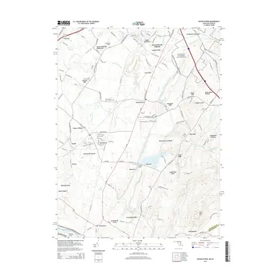
2014 Map of Buckeystown
USGS Topo · Published 2014About this map
The Monocacy River winds through the heart of this Frederick County landscape, where the Monocacy National Battlefield preserves the site of significant Civil War history. To the south, the Potomac River forms the natural boundary, accompanied by the C & O Canal National Historical Park and Nolands Island. This area is defined by a dense network of early settlements and family landmarks, from the industrial heritage of Michaels Mill and Lime Kiln to established communities like Buckeystown and Adamstown. The geography is further marked by the Culpeper Basin and the prominent rise of Sugar Loaf Mtn in the southeast. Genealogists can find several burial grounds, including Saint Matthews Cem, Koontz Cem, and Saint Josephs Carrollton Manor Cem, while the B & O RR corridor provides a clear view of the region's historical transport infrastructure.
Find a feature on this map
130 named features on this map. Tap any name to fly to it.
Don’t see what you’re looking for? This feature index may not catch every label — zoom into the map to look around manually.
Map Details
Editions of this 2014 Buckeystown Map
This is the sole edition of this map. No revisions or reprints were ever made.
Other maps of this area

1884 · Harpers Ferry
USGS Topo · 1:125,000

1891 · Harpers Ferry
USGS Topo · 1:125,000

1893 · Frederick
USGS Topo · 1:125,000

1893 · Harpers Ferry
USGS Topo · 1:125,000

1894 · Frederick
USGS Topo · 1:125,000

1908 · Middletown
USGS Topo · 1:48,000

1908 · Seneca
USGS Topo · 1:62,500

1908 · Ijamsville
USGS Topo · 1:62,500

1909 · Ijamsville
USGS Topo · 1:62,500

1910 · Antietam
USGS Topo · 1:62,500