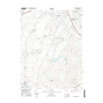
2016 Map of Buckeystown
USGS Topo · Published 2016About this map
The Monocacy National Battlefield anchors the northern portion of this landscape where the Monocacy River winds toward its confluence with the Potomac River. This corridor is defined by its deep agricultural and industrial roots, evidenced by the presence of Michaels Mill and Greenfield Mills. The map details a network of historic settlements including Buckeystown, Adamstown, and the curiously named Lilypons. To the south, the terrain rises toward the prominent Sugar Loaf Mtn near the boundary with Montgomery County. Genealogists will find a wealth of specific data, from the Saint Josephs Carrollton Manor Cem to smaller family plots like the Koontz Cem and Yingling Cem. The southwestern corner is bordered by the Chesapeake and Ohio Canal National Historical Park, tracing the river's edge at Nolands Island.
Find a feature on this map
125 named features on this map. Tap any name to fly to it.
Don’t see what you’re looking for? This feature index may not catch every label — zoom into the map to look around manually.
Map Details
Editions of this 2016 Buckeystown Map
This is the sole edition of this map. No revisions or reprints were ever made.
Other maps of this area

1884 · Harpers Ferry
USGS Topo · 1:125,000

1891 · Harpers Ferry
USGS Topo · 1:125,000

1893 · Frederick
USGS Topo · 1:125,000

1893 · Harpers Ferry
USGS Topo · 1:125,000

1894 · Frederick
USGS Topo · 1:125,000

1908 · Middletown
USGS Topo · 1:48,000

1908 · Seneca
USGS Topo · 1:62,500

1908 · Ijamsville
USGS Topo · 1:62,500

1909 · Ijamsville
USGS Topo · 1:62,500

1910 · Antietam
USGS Topo · 1:62,500