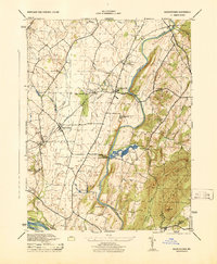
1944 Map of Buckeystown
USGS Topo · Published 1944About this map
The Monocacy River snakes southward through this Frederick County landscape, serving as a central artery for a region defined by mid-century agriculture and milling. During this era, small industrial and social hubs like Michaels Mill and the Buckingham School Orphanage anchored the local community. The transportation network is dominated by the Baltimore and Ohio railroad, which supported settlements such as Adamstown and Buckeystown Station.
Find a feature on this map
31 named features on this map. Tap any name to fly to it.
Don’t see what you’re looking for? This feature index may not catch every label — zoom into the map to look around manually.
Map Details
Editions of this 1944 Buckeystown Map
This is the sole edition of this map. No revisions or reprints were ever made.
Other maps of this area

1884 · Harpers Ferry
USGS Topo · 1:125,000

1891 · Harpers Ferry
USGS Topo · 1:125,000

1893 · Frederick
USGS Topo · 1:125,000

1893 · Harpers Ferry
USGS Topo · 1:125,000

1894 · Frederick
USGS Topo · 1:125,000

1908 · Middletown
USGS Topo · 1:48,000
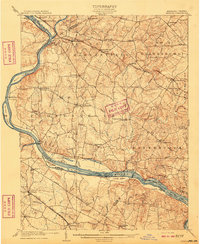
1908 · Seneca
USGS Topo · 1:62,500

1908 · Ijamsville
USGS Topo · 1:62,500

1909 · Ijamsville
USGS Topo · 1:62,500

1910 · Antietam
USGS Topo · 1:62,500