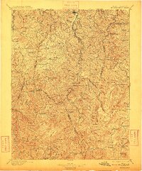
1896 Map of Buckhannon
USGS Topo · Published 1909About this map
Buckhannon serves as the focal point for this late nineteenth-century survey, illustrating a landscape defined by the branching tributaries of the Monongahela River and the Little Kanawha River. The mapping captures the expansion of timber and transport interests through the winding routes of the West Virginia and Pittsburg RR and the Alexander and Rich Mountain RR. In the high, dissected plateaus to the south, small mountain communities and landmarks like Selbyville, Alexander, and Hacker Valley are meticulously documented alongside numerous family-named peaks such as Cochran Knob and Beverage Knob. The distribution of rural spiritual and social centers is evident through the labeling of Goshen Church, Fairview Church, and local industrial points like Alkires Mill. This edition preserves the intricate boundary lines between Lewis, Upshur, Webster, and Randolph counties before the era of modern highway development.
Find a feature on this map
154 named features on this map. Tap any name to fly to it.
Don’t see what you’re looking for? This feature index may not catch every label — zoom into the map to look around manually.
Map Details
Editions of this 1896 Buckhannon Map
3 editions found

Other maps of this area

1886 · St. George
USGS Topo · 1:125,000

1889 · Nicholas
USGS Topo · 1:125,000

1889 · Beverly
USGS Topo · 1:125,000

1891 · Nicholas
USGS Topo · 1:125,000

1891 · Huntersville
USGS Topo · 1:125,000

1891 · St. George
USGS Topo · 1:125,000

1892 · Beverly
USGS Topo · 1:125,000

1893 · Buckhannon
USGS Topo · 1:125,000

1893 · Sutton
USGS Topo · 1:125,000

1894 · Huntersville
USGS Topo · 1:125,000