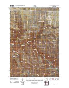
2011 Map of Buckhorn Canyon
USGS Topo · Published 2011About this map
Butte Creek and its complex network of tributaries define this deeply eroded portion of Wheeler County, Oregon. The landscape is characterized by a series of prominent drainages named after local families or geographical features, including Jumpoff Canyon, Bales Canyon, and Yantis Canyon. In the early 21st century, these canyons served as the primary conduits for local travel and ranching access, with Buckhorn Rd and Butte Creek Rd following the high ground and creek beds. The drainage system reveals the area's hydrology, where the North Fork Butte Creek and West Fork Butte Creek converge to form the main channel. Distinctive landmarks such as Sand Spring and Greasewood Canyon provide essential reference points in this high-desert environment, while smaller named cuts like Big Stewart Canyon and Little Stewart Canyon illustrate the intricate local topography documented by the USGS.
Find a feature on this map
19 named features on this map. Tap any name to fly to it.
Don’t see what you’re looking for? This feature index may not catch every label — zoom into the map to look around manually.
Map Details
Editions of this 2011 Buckhorn Canyon Map
This is the sole edition of this map. No revisions or reprints were ever made.
Other maps of this area
1916 · Condon
USGS Topo · 1:125,000
1926 · Mitchell
USGS Topo · 1:125,000

1953 · The Dalles
USGS Topo · 1:250,000

1955 · Bend
USGS Topo · 1:250,000

1956 · The Dalles
USGS Topo · 1:250,000

1957 · Bend
USGS Topo · 1:250,000
1957 · The Dalles
USGS Topo · 1:250,000
1958 · Bend
USGS Topo · 1:250,000
1966 · Kinzua
USGS Topo · 1:62,500
1966 · Clarno
USGS Topo · 1:62,500