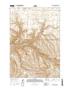
2017 Map of Buckhorn Canyon
USGS Topo · Published 2017About this map
Butte Creek and its various tributaries, including the North Fork and West Fork, define the drainage patterns across the boundary of Gilliam and Wheeler Counties. This interior Oregon landscape is dominated by a complex network of deeply incised canyons, many bearing the names of early local families or descriptive land markers such as Big Stewart Canyon, Yantis Canyon, Poodle Canyon, and Bales Canyon.
Find a feature on this map
27 named features on this map. Tap any name to fly to it.
Don’t see what you’re looking for? This feature index may not catch every label — zoom into the map to look around manually.
Map Details
Editions of this 2017 Buckhorn Canyon Map
This is the sole edition of this map. No revisions or reprints were ever made.
Other maps of this area
1916 · Condon
USGS Topo · 1:125,000
1926 · Mitchell
USGS Topo · 1:125,000

1953 · The Dalles
USGS Topo · 1:250,000

1955 · Bend
USGS Topo · 1:250,000

1956 · The Dalles
USGS Topo · 1:250,000

1957 · Bend
USGS Topo · 1:250,000
1957 · The Dalles
USGS Topo · 1:250,000
1958 · Bend
USGS Topo · 1:250,000
1966 · Kinzua
USGS Topo · 1:62,500
1966 · Clarno
USGS Topo · 1:62,500