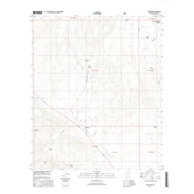
2017 Map of Buckhorn
USGS Topo · Published 2017About this map
Buckhorn serves as the central hub of this high-desert landscape in Grant County, where the topography is defined by the drainage systems of Duck Cr and Buckhorn Cr. The settlement is surrounded by a complex network of canyons, including Little Pat Canyon, Big Pat Canyon, and Foster Canyon, which carve through the arid terrain. To the northeast, the boundary of the Gila National Forest marks a transition into protected lands, featuring landmarks like Mud Spring Mesa and the aptly named Mud Spring. Water management is a visible priority for local ranching and land use, evidenced by features such as George Clark Tank and Horse Lake Tank. The map also captures the distinct land divisions of the Public Land Survey System, with numerous canyons and draws named after early settlers or geographical features, such as Shields Canyon and Brown Canyon.
Find a feature on this map
36 named features on this map. Tap any name to fly to it.
Don’t see what you’re looking for? This feature index may not catch every label — zoom into the map to look around manually.
Map Details
Editions of this 2017 Buckhorn Map
This is the sole edition of this map. No revisions or reprints were ever made.
Other maps of this area

1910 · Mogollon
USGS Topo · 1:125,000

1912 · Mogollon
USGS Topo · 1:125,000

1954 · Silver City
USGS Topo · 1:250,000

1954 · Clifton
USGS Topo · 1:250,000

1957 · Clifton
USGS Topo · 1:250,000

1958 · Silver City
USGS Topo · 1:250,000

1958 · Clifton
USGS Topo · 1:250,000

1959 · Steeple Rock
USGS Topo · 1:62,500

1959 · Cliff
USGS Topo · 1:62,500

1962 · Silver City
USGS Topo · 1:250,000