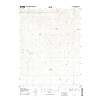
2014 Map of Buckhorn Mine
USGS Topo · Published 2014About this map
Buckhorn Mine and the adjacent settlement of Buckhorn sit within the high-elevation terrain of the Cortez Mountains, reflecting the enduring legacy of resource extraction in Eureka County. This 2014 survey captures a landscape defined by industrial access and natural water sources, where Buckhorn Rd and Buckhorn Ranch Rd provide the primary transit through the rugged mountain passes.
Find a feature on this map
27 named features on this map. Tap any name to fly to it.
Don’t see what you’re looking for? This feature index may not catch every label — zoom into the map to look around manually.
Map Details
Editions of this 2014 Buckhorn Mine Map
This is the sole edition of this map. No revisions or reprints were ever made.
Other maps of this area

1938 · Cortez
USGS Topo · 1:48,000

1944 · Cortez
USGS Topo · 1:62,500

1949 · Crescent Valley
USGS Topo · 1:62,500

1950 · Crescent Valley
USGS Topo · 1:62,500

1955 · Winnemucca
USGS Topo · 1:250,000

1957 · Frenchie Creek
USGS Topo · 1:62,500

1957 · Horse Creek Valley
USGS Topo · 1:62,500

1958 · Winnemucca
USGS Topo · 1:250,000

1962 · Winnemucca
USGS Topo · 1:250,000
1985 · Thatcher Spring
USGS Topo · 1:24,000