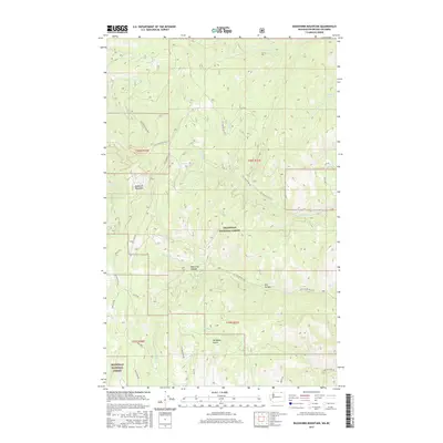
2017 Map of Buckhorn Mountain
USGS Topo · Published 2017About this map
Buckhorn Mountain dominates this portion of the Okanogan National Forest, where the landscape is defined by a dense network of forest development roads and steep drainages. The 2017 terrain is deeply incised by features such as Bear Trap Canyon, Bat Canyon, and Westphal Gulch, illustrating the complex topography of this Okanogan County region. Water sources are scattered across the high country, including Jackson Spring and the headwaters of W Fork Cedar Cr and N Fork Gold Cr. The road network, comprising routes like Cow Camp Rd, Fish Mountain Rd, and Nat For Dev Rd 3575, reflects the active management and accessibility of these timberlands and recreation areas. For those researching the geography of the Pacific Northwest, these details show how natural contours and human infrastructure intersect in this remote part of Washington.
Find a feature on this map
34 named features on this map. Tap any name to fly to it.
Don’t see what you’re looking for? This feature index may not catch every label — zoom into the map to look around manually.
Map Details
Editions of this 2017 Buckhorn Mountain Map
This is the sole edition of this map. No revisions or reprints were ever made.
Other maps of this area

1902 · Osoyoos
USGS Topo · 1:125,000

1904 · Osoyoos
USGS Topo · 1:125,000

1904 · Republic
USGS Topo · 1:125,000

1951 · Bodie Mountain
USGS Topo · 1:62,500

1954 · Okanogan
USGS Topo · 1:250,000

1957 · Mt. Bonaparte
USGS Topo · 1:62,500

1958 · Okanogan
USGS Topo · 1:250,000

1958 · Bodie Mtn
USGS Topo · 1:62,500

1984 · Oroville
USGS Topo · 1:100,000

1984 · Republic
USGS Topo · 1:100,000