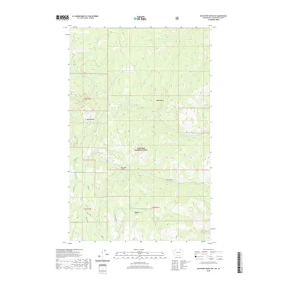
2020 Map of Buckhorn Mountain
USGS Topo · Published 2020About this map
Buckhorn Mtn dominates this section of the Okanogan National Forest, where the high terrain of the Okanogan Highlands is carved by a complex network of canyons and gulches. The landscape is defined by its drainage systems, featuring the headwaters of Jackson Cr, Gold Cr, and Bolster Cr as they cut through the steep slopes. While largely a wilderness area, the map reveals a history of land management and access through a spiderweb of named forest roads such as Crystal Butte Rd and Skully Rd. These routes, along with landmarks like Jackson Spring and Westphal Gulch, indicate a legacy of ranching, mining, or timber activity within this northern Washington forest. The detailed topography illustrates the transition from high peaks down into lower drainage basins like Bear Trap Canyon and Bat Canyon.
Find a feature on this map
33 named features on this map. Tap any name to fly to it.
Don’t see what you’re looking for? This feature index may not catch every label — zoom into the map to look around manually.
Map Details
Editions of this 2020 Buckhorn Mountain Map
This is the sole edition of this map. No revisions or reprints were ever made.
Other maps of this area

1902 · Osoyoos
USGS Topo · 1:125,000

1904 · Osoyoos
USGS Topo · 1:125,000

1904 · Republic
USGS Topo · 1:125,000

1951 · Bodie Mountain
USGS Topo · 1:62,500

1954 · Okanogan
USGS Topo · 1:250,000

1957 · Mt. Bonaparte
USGS Topo · 1:62,500

1958 · Okanogan
USGS Topo · 1:250,000

1958 · Bodie Mtn
USGS Topo · 1:62,500

1984 · Oroville
USGS Topo · 1:100,000

1984 · Republic
USGS Topo · 1:100,000