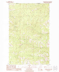
1988 Map of Buckhorn Mountain
USGS Topo · Published 1988About this map
Buckhorn Mountain dominates the high-altitude landscape of northern Okanogan County, just south of the Canada-United States border. This late 1980s topography reveals a history of extraction concentrated on the mountain's western slopes, where multiple operations such as the Buckhorn Mine, Magnetic Mine, and Roosevelt Mine are marked alongside numerous unnamed prospects. These industrial sites are supported by seasonal outposts like Gold Axe Camp and Roosevelt Camp, indicating the sustained interest in the area's geological resources.
Find a feature on this map
36 named features on this map. Tap any name to fly to it.
Don’t see what you’re looking for? This feature index may not catch every label — zoom into the map to look around manually.
Map Details
Editions of this 1988 Buckhorn Mountain Map
This is the sole edition of this map. No revisions or reprints were ever made.
Other maps of this area

1902 · Osoyoos
USGS Topo · 1:125,000

1904 · Osoyoos
USGS Topo · 1:125,000

1904 · Republic
USGS Topo · 1:125,000

1951 · Bodie Mountain
USGS Topo · 1:62,500

1954 · Okanogan
USGS Topo · 1:250,000

1957 · Mt. Bonaparte
USGS Topo · 1:62,500

1958 · Okanogan
USGS Topo · 1:250,000

1958 · Bodie Mtn
USGS Topo · 1:62,500

1984 · Oroville
USGS Topo · 1:100,000

1984 · Republic
USGS Topo · 1:100,000