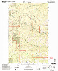
2001 Map of Buckhorn Mountain
USGS Topo · Published 2004About this map
The mining history of the northern Cascades is etched into the terrain of Buckhorn Mountain, just south of the border between the United States and Canada. This survey reflects the landscape at the turn of the 21st century, where the slopes are marked by a concentration of historical extraction sites, including the Magnetic Mine, Gold Axe Mine, and the Buckhorn Mine. Numerous mineshaft and prospect labels indicate the intensive search for minerals in this part of the Okanogan National Forest.
Find a feature on this map
27 named features on this map. Tap any name to fly to it.
Don’t see what you’re looking for? This feature index may not catch every label — zoom into the map to look around manually.
Map Details
Editions of this 2001 Buckhorn Mountain Map
This is the sole edition of this map. No revisions or reprints were ever made.
Other maps of this area

1902 · Osoyoos
USGS Topo · 1:125,000

1904 · Osoyoos
USGS Topo · 1:125,000

1904 · Republic
USGS Topo · 1:125,000

1951 · Bodie Mountain
USGS Topo · 1:62,500

1954 · Okanogan
USGS Topo · 1:250,000

1957 · Mt. Bonaparte
USGS Topo · 1:62,500

1958 · Okanogan
USGS Topo · 1:250,000

1958 · Bodie Mtn
USGS Topo · 1:62,500

1984 · Oroville
USGS Topo · 1:100,000

1984 · Republic
USGS Topo · 1:100,000