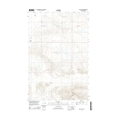
2014 Map of Buckley Lake
USGS Topo · Published 2014About this map
Buckley Lake sits at the center of this 2014 survey in Phillips County, Montana, surrounded by the intricate drainage systems and high ridges of the northern plains. The landscape is defined by extensive coulees that carve through the elevation, including Plummer Coulee and Wilson Coulee, leading toward the southern reaches of the Larb Hills. To the north, the terrain levels out into the Sun Prairie Flats, while the southern portion of the quadrangle rises toward Collins Hill and the complex drainages of Badland Coulee and North Shotgun Coulee. Rural access is maintained via the Content Rd and Tallow Creek Rd, illustrating the modern cattle-ranching and prairie infrastructure of this section of the Big Dry country. The map traces the winding paths of Tallow Cr and Sage Cr, showing how water availability dictates the movement of both trails and boundaries in this expansive environment.
Find a feature on this map
18 named features on this map. Tap any name to fly to it.
Don’t see what you’re looking for? This feature index may not catch every label — zoom into the map to look around manually.
Map Details
Editions of this 2014 Buckley Lake Map
This is the sole edition of this map. No revisions or reprints were ever made.
Other maps of this area

1954 · Jordan
USGS Topo · 1:250,000

1954 · Glasgow
USGS Topo · 1:250,000

1956 · Jordan
USGS Topo · 1:250,000

1957 · Glasgow
USGS Topo · 1:250,000

1958 · Glasgow
USGS Topo · 1:250,000

1958 · Jordan
USGS Topo · 1:250,000

1964 · Jordan
USGS Topo · 1:250,000

1965 · Coal Mine Hill
USGS Topo · 1:24,000

1965 · Sun Prairie
USGS Topo · 1:24,000

1965 · Buckley Lake
USGS Topo · 1:24,000